The Trails in Wilder's Name Weren't a Landscaping Choice. They Were the Terms of a Deal.
August 20, 2026
August 20, 2026
Park in the gravel lot near Wilder Fields on a Saturday morning and you'll see the same thing most weeks: a stroller crowd heading toward Sibley, a mountain biker checking tire pressure, someone's dog straining against a leash toward a trailhead sign that lists rules most residents have never fully read. The sign isn't decoration. It's the fine print of a land deal three decades in the making, and living inside Wilder means living inside that deal, whether or not you've ever noticed the boundary lines.
Most people who talk about this Orinda neighborhood start with the Quarry House. It's an easy place to start. The $8 million clubhouse, built in Spanish Colonial Revival style, anchors the community with a competition-length pool, a fitness center, yoga studios, and a patio with built-in fireplaces that turns a Tuesday swim into a small event. A short drive away, Wilder Fields hosts the youth soccer and baseball games that fill the weekend calendar, five turf fields tucked into rolling hills known locally for producing wildly different weather on the same afternoon. Parents who've coached there long enough know to pack sunscreen and a windbreaker in the same bag, because one field can bake while another gets hit by a cold gust off the ridge.
Those two amenities get the attention because they're visible and built by the developer specifically for residents. The trails are different. They weren't built for Wilder. They were negotiated around it.
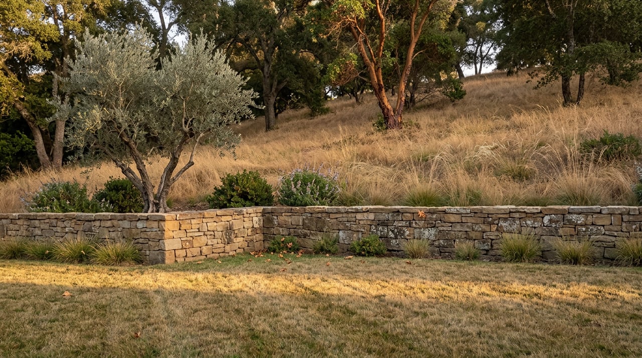
When Brooks Street assembled the land for what eventually became 245 home sites, the parcel ran to roughly 1,500 acres. Home construction was clustered onto about 200 of them, a deliberate choice that let the rolling hills and creek drainages on the other three sides stay largely untouched. The remaining acreage, more than 1,300 acres in total, was transferred to the East Bay Regional Park District and the East Bay Municipal Utility District in 2011.
That transfer included a 250-plus-acre parcel once owned by the McCosker family, who ranched it starting in the 1870s before it became a quarry and paving operation through the 1950s and into the 1970s. The land now carries a new name, appended to Sibley Volcanic Regional Preserve as the McCosker Loop Trail, reached from a newer trailhead on Pinehurst Road called the Wilcox Station Staging Area, named for a stop on the old Sacramento Northern Railroad line that once ran through the canyon. A citizen group called Save Open Space, working with the Golden Gate Audubon Society, pushed for the parcel's protection rather than further development.
None of that history shows up on a listing sheet. It shows up on the trail map, in the shape of which loops connect to which preserve and why a two-mile stretch feels older and wilder than the manicured paths closer to the homes.
In 2018, the City of Orinda and the developer finalized an agreement designating many of Wilder's trails open to the public from dawn to dusk. That sounds like a simple amenity until you learn what sits underneath most of that open space: a conservation easement held by the nonprofit Wildlife Heritage Foundation, covering habitat for two federally listed threatened species, the California red-legged frog and the Alameda whipsnake.
Dr. Darla Guenzler, the foundation's executive director, put the arrangement plainly in a 2021 interview with the Orinda News: wildlife preserves and people can coexist, but only if residents remember they are visitors in someone else's habitat, not the other way around. That's not a throwaway line. It's the reason certain trail segments ban dogs, why some require an EBMUD permit and others don't, and why a shortcut that looks perfectly walkable on satellite view might be closed to protect a breeding population that most hikers will never see.
The valley rewards patience for the ones who do watch closely. Coyotes, deer, rabbits, and wild turkeys are common enough to be unremarkable to longtime residents. Red-tailed hawks, swallows, and eagles work the ridgeline above, part of the same open space that makes the neighborhood's trail rules worth taking seriously.
Not every entry point leads to the same experience, and mixing them up costs you either a parking spot or a permit fee.
Treat them as interchangeable and you'll eventually find yourself turned around on a trail built for a different purpose than the one you meant to walk.
The land deal that shaped Wilder didn't finish quietly. In January 2024, Lamorinda Weekly reported that after roughly thirty years of work, the developer had completed its obligations under the original agreement, and that a hiking-trail staging area once planned for the community was eliminated rather than built. It's a small detail in the arc of a decades-long project, but it's a useful reminder that the trail network residents use today isn't a fixed inheritance. It's the current draft of an agreement that kept getting renegotiated as the project moved from ranch land to quarry to subdivision to open space, each phase leaving its own mark on where the paths actually go.
That's the part the brochures leave out. The Quarry House and Wilder Fields are the neighborhood's built amenities, finished, fixed, and easy to photograph. The trails are the leftover terms of a longer argument about what this land was supposed to be, an argument that involved a citizen group, a federal wildlife listing, a park district, and a developer who spent three decades meeting obligations that shifted along the way. Walking those trails on a Saturday morning means walking through the outcome of that argument, whether the person next to you on the path knows it or not.
If you're weighing a move to Wilder, or already live here and are curious what a well-marketed sale in this kind of neighborhood actually looks like, Alexis Thompson has spent years working the Lamorinda corridor and can walk you through what makes a property here stand out, trail access included. Reach out any time for a conversation about the neighborhood, no pressure, no obligation.
This article is general information, not legal, tax or financial advice. Consult a qualified professional about your situation.
Stay up to date on the latest real estate trends.
Etiam non quam lacus suspendisse faucibus interdum. Orci ac auctor augue mauris augue neque. Bibendum at varius vel pharetra. Viverra orci sagittis eu volutpat.