Briones Just Made Its Trail-Sharing Rules Permanent. They Don't Apply to the Path Out of Happy Valley.
August 27, 2026
August 27, 2026
Walk up Panorama Drive past Happy Valley Elementary on any Saturday morning and you'll see the same regulars: a runner with a dog on a slack leash, a couple pushing bikes past the crosswalk, someone with a daypack heading for the "END, no parking beyond this point" sign where the pavement gives out and the fire road begins. Ask any of them about Briones Regional Park's bike-and-horse schedule and you'll likely hear some version of the same thing: odd days for mountain bikes, even days for horses, so check the calendar before you go.
That schedule is real. It just isn't the schedule that governs the trail leaving Happy Valley.
For twenty months, from April 2023 to December 2024, the East Bay Regional Park District ran what it called the Briones Trails Pilot Project: an experiment in sharing singletrack between hikers, mountain bikers, and equestrians without everyone colliding on the same narrow grade. The rules were specific. On odd-numbered weekend days, bikes and hikers had the run of certain trails with no horses allowed. On even days, horses and hikers had it with no bikes. A handful of trail segments were designated bike-only and downhill-only, signed at both ends. Part of the project also meant closing "bootleg" trails, the unofficial cuts riders had carved into the hillside over the years, and restoring the ground underneath them.
On December 17, 2024, the park district's board of directors made the arrangement permanent. They amended the park's governing ordinance to add 5.75 miles of trail to the official system and formalized the odd-even schedule as standing policy rather than a two-year test. The Bicycle Trails Council of the East Bay's own account of 2025 called it plainly: last year was the first full calendar year of long-term legal singletrack access in Briones, and it came with real follow-through, including additional trail work on segments like Curl of the Burl and Hank & Frank, and the park's first joint trail mixer, a gathering that brought mountain bikers, hikers, and equestrians together for group rides and tacos rather than arguments about right of way.
That's a genuine shift in how one of the East Bay's busiest parks operates. It's just happening in a different part of the park than the one most Happy Valley residents actually use.
The pilot project, now the Briones Special Management Area, covers a 1,600-acre zone in the park's northeast corner. The park district's own map places its access points at the Alhambra Creek Staging Area near Martinez, the Old Briones Road staging area, the Reliez Valley staging area, and the park office entrance near Pine Tree Trail. Every one of those is reached from Martinez or Reliez Valley Road, well away from the Lafayette side of the park.
The trail most Happy Valley residents actually walk out their door and onto starts somewhere else entirely. The Walter Costa Trail, named for a Lafayette architect and city councilman who spent years on the East Bay Regional Park District's board advocating for local parks and trails, runs from the Lafayette Reservoir over Quail Ridge, past Happy Valley Elementary, and up Panorama Drive into Briones from the south. From there it connects to the Russell Peak Trail and, beyond that, the Lafayette Ridge Trail. None of those trails appear on the park district's list of Special Management Area access points, and nothing in that ordinance amendment mentions restricting them by odd or even day. If you're heading out from Panorama Drive, the day of the week you pick has nothing to do with a rule written for a different corner of the park entirely.
That distinction matters if you've ever second-guessed a Saturday ride because of something you half-remembered from Nextdoor. It also matters if you're the kind of person who reads "Briones trail rules" and assumes it's one uniform policy across 6,117 acres. It isn't. It's two different management regimes stitched into one park boundary, and the one that gets talked about most is not the one at the top of your own street.
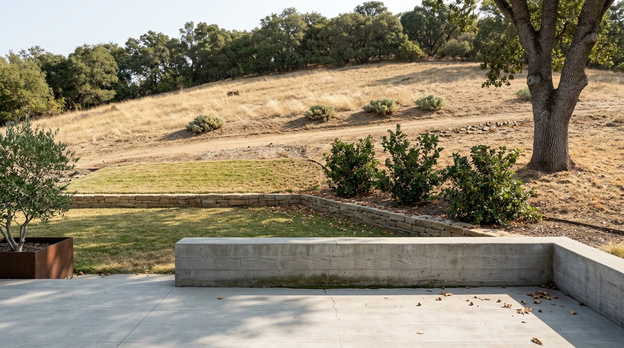
The route itself has its own landmarks, most of which have nothing to do with any pilot program. Head up Panorama Drive past the school, continue past the dead-end sign, and the Mariposa Trail winds west along the hillside for close to a mile with open views back over Lafayette before it meets a three-way junction and becomes the Russell Peak Trail.
Partway up that climb, on the left, sits the Leuschner Observatory: a working astronomical facility built in 1886 on the UC Berkeley campus and physically relocated to this hillside in 1965. It sits on the Russell Preserve, a 283-acre research station the university has used for forestry study since 1961, and it's the kind of landmark you'd never guess was there from the road below.
Past the observatory, a short unmarked side trail climbs to Russell Peak at 1,357 feet, not the highest point in the park (that distinction belongs to Briones Peak, at 1,483 feet, elsewhere in the park) but close enough to deliver a full sweep from Mount Diablo across to Round Top at Sibley Volcanic Regional Preserve. A plain bench near the top is dedicated to a woman named Janet who apparently loved this exact view enough that someone made sure it would outlast her.
The land itself has a working history too. Grazing cattle, sheep, and goats still range across portions of Briones under a lease with the park district that runs until the 2060s, which explains why a hiker on certain trails will occasionally have to wait out a small herd crossing the path. It isn't decoration. It's an active agricultural use that predates the park and was written into how the park operates.
If you haven't made the walk in a while, or you've been avoiding it because you assumed a schedule applied that doesn't, here's the route as it actually runs:
None of this requires checking a calendar first. It requires knowing the route exists, which is the part most generic neighborhood guides skip in favor of a sentence about Briones having "trails for hiking and biking" and moving on.
Happy Valley's back-door access to a 6,000-plus acre regional park is one of the things that makes the neighborhood what it is, not because it's rare in the Lamorinda area but because so few residents actually walk the full loop past their own school and up into the hills their kids can see from the driveway. Worth doing once, if only to see the observatory and the bench for yourself.
If you're weighing a move into Happy Valley, or thinking about what your own property here is worth in a market where local knowledge like this actually shapes buyer interest, Alexis Thompson has spent years walking these same streets and can talk you through it, starting with a free home valuation.
Stay up to date on the latest real estate trends.
Etiam non quam lacus suspendisse faucibus interdum. Orci ac auctor augue mauris augue neque. Bibendum at varius vel pharetra. Viverra orci sagittis eu volutpat.